We’ve dug through the science to show you what and why.
How Bad Will This Year’s Hurricane Season Be in Texas?
Probably the biggest factor effecting your Texas electric bill is weather. It not only directly influences how much you use to heat or cool your home but also effects the entire demand, supply, and price of energy on the wholesale markets. Hurricane season especially can have a critical effect on the price of energy, particularly as hundreds of oil and natural gas rigs are at in the Gulf of Mexico, one of the most active areas for tropical storms in the Americas. The Atlantic Hurricane Season runs from June 1 through November 30. Each year, several different storm forecasting centers release their forecasts either months in advance or just few days before the season “officially” begins. Most recently on April 5, Colorado State University’s (CSU) Tropical Meteorology Project released its annual long range hurricane forecast. So far, it’s starting to look like the 2018 Hurricane will look a lot like the 2017 Hurricane season.
So, if you’re living in Houston or Dallas or anywhere else in Texas, make your best plan for facing some really powerful storms this summer.
Texas Hurricane Predictions, 2018
An average Atlantic hurricane season has 12 named tropical storms, 6 hurricanes (category 1-2), and 2 major hurricanes (category 3-5). In contrast, last year’s hurricane season produced 17 tropical storms, 10 hurricanes, and 8 major hurricanes — including the devastating Category 4 Hurricane Harvey.
CSU is predicting that the 2018 Atlantic basin hurricane season will have slightly above-average activity. They also predict a slightly above-average probability for major hurricanes making landfall along the continental United States coastline and in the Caribbean.
| CSU Prediction | Seasonal Average, 1981-2010 |
|
| Named storms (winds 39 mph+) |
14 | 12 |
| Hurricanes (winds 74 mph+) |
7 | 6 |
| Category 3, 4 or 5 hurricanes (winds 111 mph+) |
3 | 2 |
Unfortunately, the 2018 season exhibits many similar conditions that were present at the beginning of last year’s season.
Dangerous Bath Water
Tropical storms and hurricanes find energy from heat and convection. Most of the heat comes from hot water evaporating into the sky, pulling in more air and evaporating water in behind it. This evaporating air rises in a spiral and the faster it pulls in heat energy, the faster it grows stronger, and ultimately develops into a storm system. Sea surface temperatures (SST) need to be about 82°F (27.77° C) for tropical storms to form. How warm is that? Think luxuriously warm bath water.
Last summer, there was a LOT of warm water available between the Americas and the coast of west Africa to spawn several storm systems. Current measurements of SSTs in the equatorial area of the eastern tropical Atlantic (off the African coast) show the water’s warm —between 71.°F and 82.4 °F. There are still anomalous areas with SSTs cooler than average temperature but these areas are largely less than 2°F (1°C) below the average, CSU ’s forecasters say there is still “considerable uncertainty” about what SSTs in the tropical Atlantic will look like over the summer.
Still, it’s important to point out that last year’s Atlantic SST during this same time were considerably cooler and covering a larger area. To be sure, there is a lot of warm water getting warmer and storing up more storm energy every day. But how much that will effect storm development may be too early to tell.
One other tid-bit to keep in mind is that research concerning the slowing down of the Atlantic Meridional Overturning Circulation (AMOC) is suggesting that this may lead to concentrations of warmer than average SSTs near North American coasts. That includes dense metropolitan areas like Houston in the Gulf of Mexico and further north along the Atlantic coast. Such concentrations of warm water could extend hurricane lifespan and increase the threat to major urban centers that don’t usually see many hurricanes like Washington, DC, Baltimore, Wilmington, DE, Philadelphia, New York, Long Island, New Haven, and Boston.
What is ENSO?
The main thing effecting hurricanes is the El Niño Southern Oscillation (ENSO). To recap, an El Niño is when warm water at the equator in the Pacific Ocean shifts the circulation of the atmosphere so that winters are warmer for most of North America (Texas is cooler and wetter). La Niñas, meanwhile, occur when colder than average water spreads through the same area of the Pacific. These tend to bring colder winters to North America (Texas is warmer and dryer). ENSO Neutral is when — well, the water temperature equator in the Pacific Ocean is average. That means the area exerts little influence on the atmosphere, allowing other phenomena to exert more.
This past winter had a weak La Niña and it is fading to ENSO Neutral. Now, the good news for next winter is that this ENSO Neutral expected to transition to an El Niño by fall —which is good news for Texas energy bills this winter. Unfortunately, it will be too late to affect the hurricane season.
During La Niña years, there are usually more hurricanes because La Niña alters the circulation of the atmosphere so that hurricanes coming across the Atlantic towards the Caribbean don’t face much wind shear at upper levels. During El Niño years, upper level wind shearing tears hurricanes apart. Unfortunately, ENSO Neutral years don’t usually have much wind shearing, either. Last year was also an ENSO neutral year.
Will a Hurricane Hit My Texas Town?
The CSU forecast for one major storm to make landfall is 63%. While those kind of odds might not frighten some folks, it’s crucial to remember that it only takes one storm to create a disaster. Tropical storms and hurricanes don’t end as soon as they hit land — they often wander far inland, bringing torrential rains, flooding, and tornados. When Hurricane Harvey hit Texas last year, it wreaked havoc not only on Houston’s electrical supply and distribution system but also on eight other states.
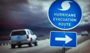
Learn to keep your family safe when the power goes out by preparing for the worst storm now. Check out Ready.gov for more information on how you can weather these summer storms.
At the end of May, NOAA will release its 2018 hurricane season forecast. . NOAA’s list of names for the upcoming storm season can be found here.